British Columbia Winter Storm Alert: March 2026 Trend Summary
Environment Canada has issued a series of wind warnings and snow special weather statements for British Columbia as a powerful Pacific storm sweeps across the province. The weather event, beginning March 10, 2026, has brought a mix of heavy snow to high elevations and intense wind gusts to coastal regions. Residents across Vancouver Island, the Lower Mainland, and the Interior are facing significant travel disruptions and potential power outages during this late-season wintry blast.

TL;DR
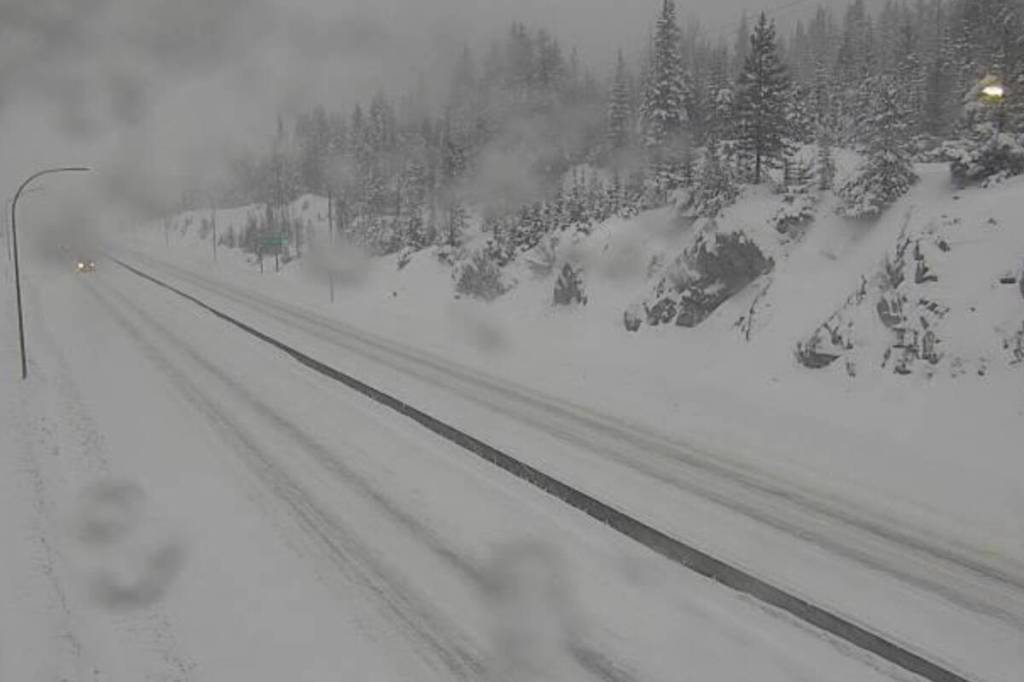
- Heavy snowfall ranging from 10 cm to 60 cm is impacting high-elevation highways and mountain passes.
- Wind gusts reaching up to 100 km/h are triggering warnings for coastal communities and northern Vancouver Island.
- The storm is causing hazardous driving conditions on the Coquihalla, Connector, and Trans-Canada highways.
- Vancouver remains on track for a near record-low snow winter despite this recent chilly temperature dip.
What Happened
A significant Pacific storm system crossed into British Columbia on March 10, 2026, bringing a rapid shift in weather conditions. Environment Canada moved quickly to issue winter storm warnings for the Okanagan highways and special weather statements for the South Coast. In the Lower Mainland and Vancouver Island, the storm initially manifested as cold rain before transitioning to wet snow in areas with higher terrain. By March 11, 2026, accumulation began in earnest across the Malahat and higher elevations of Metro Vancouver.
Be prepared for sea-level snow and heavy winds across the coastal regions as this system tracks eastward.

Key Developments
The intensity of the storm varies significantly by region. On the Okanagan highways, including Highway 97C and the Coquihalla, officials are reporting massive snow totals between 10 cm and 60 cm. Coastal regions are facing a different threat, with wind warnings active for Northern Vancouver Island and the Central Coast where gusts are expected to hit 90 to 100 km/h. On Vancouver Island, high elevations could see between 5 cm and 10 cm of snow, while sea-level areas may only see trace amounts or a rain-snow mix.
Travelers are advised to check the official DriveBC portal for real-time road closures and highway conditions before departing.
Why This Matters
This weather event is critical due to its impact on transportation and public safety. The heavy, wet snow combined with high winds increases the risk of falling branches and power outages across the South Coast. For the Interior, the sudden accumulation on mountain passes creates dangerous alpine snow conditions, affecting the supply chain and commercial trucking routes. Furthermore, this storm serves as a stark contrast to Vancouver's overall winter season, which has seen unusually low snowfall totals compared to historical averages.
What Happens Next
Snow potential is expected to linger through Wednesday, March 11, 2026, for the Lower Mainland and Vancouver Island. Winds are forecast to ease by Wednesday evening as the system pushes further into the Canadian Rockies. Maintenance crews will remain on high alert through the night to clear major arterial routes. Residents are encouraged to monitor local forecasts for updated warnings as temperatures are expected to remain below seasonal norms for the remainder of the week.
Frequently Asked Questions
Which highways in BC have winter storm warnings?
Warnings are currently in effect for the Coquihalla Highway (Hope to Merritt), the Okanagan Connector (Merritt to Kelowna), and the Trans-Canada Highway (Eagle Pass to Rogers Pass), with up to 60 cm of snow expected.
How strong are the winds expected to be on the coast?
Environment Canada has warned that wind gusts could reach between 90 km/h and 100 km/h in northern Vancouver Island and parts of the Central Coast on March 10 and 11.
Will it snow in downtown Vancouver?
While snow has hit parts of Metro Vancouver, accumulation in the downtown core remains unlikely or minimal, as the city moves closer to finishing a winter with near-zero total snowfall.
Is there a risk of power outages?
Yes, the combination of heavy, wet snow and high winds increases the likelihood of tree limbs breaking and contacting power lines, particularly in the Fraser Valley and Vancouver Island.