Hawaii Kona Storm Impacts: 2026 Severe Weather Trend Summary
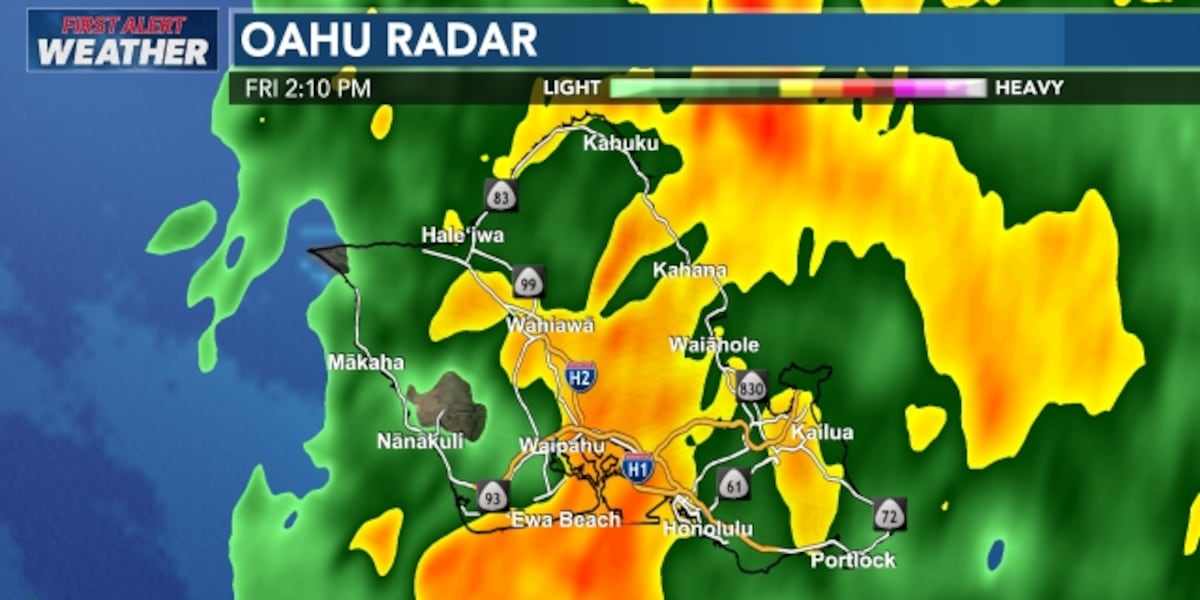
A powerful Kona Low storm is currently lashing the Hawaiian Islands with torrential rain, destructive winds, and life-threatening flash flood conditions as of March 14, 2026. State officials have issued widespread flood watches and warnings across Oahu, Kauai, and Maui as the slow-moving system continues to stall over the region. Residents are urged to avoid unnecessary travel due to rising water levels and significant road closures across multiple islands.
TL;DR
- A major Kona Low is producing 6 to 10 inches of rain, with localized areas seeing up to 20 inches.
- Flash flood warnings and road closures are in effect for Oahu, Kauai, and Maui County.
- Fierce winds exceeding 60 mph and blizzard conditions are impacting high-altitude summits.
- The storm remains a high-risk event through the weekend, threatening infrastructure and public safety.
What Happened
The weather event began intensified on March 10, 2026, when a low-pressure system developed west of the islands, drawing deep tropical moisture northward. By March 13, the system evolved into a classic Kona Low, stalling over the central Pacific and funneling relentless rain bands into the island chain. On Oahu and Kauai, rainfall rates reached 3 inches per hour, quickly overwhelming drainage systems and triggering immediate flash flood advisories.
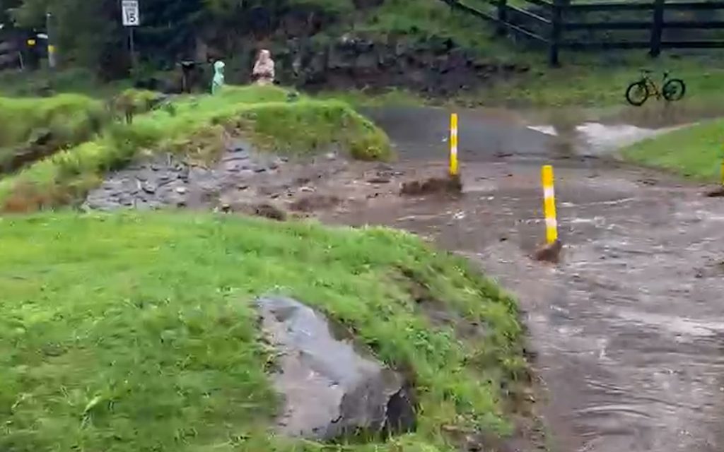
In Maui County, heavy precipitation in the Kula and Upcountry regions led to significant runoff. Authorities reported multiple road closures due to downed trees and localized landslides caused by the saturated soil. The storm forced the closure of several state parks and hiking trails as a precaution against rising stream levels.

This is a particularly dangerous situation with the potential for catastrophic flooding in low-lying areas that are already saturated from previous rains.
Key Developments
The storm has produced a diverse range of severe weather impacts across different elevations. While coastal areas face flooding, the summits of Mauna Kea and Mauna Loa are under blizzard warnings with visibility reduced to near zero. Winds at these high altitudes have been clocked at over 100 mph, while lower elevations are experiencing sustained winds of 30 to 50 mph.
Emergency management agencies have activated response centers to monitor the Kona Low storm updates provided by the County of Maui official portal. Public works crews are currently deployed to clear debris from major thoroughfares, though residents are advised to stay off the roads unless for an emergency evacuation.
Why This Matters
Kona Lows are historically significant because they bring rain to the typically dry (leeward) sides of the islands, which are not equipped with the same drainage infrastructure as the windward sides. This shift in wind direction creates high-velocity gusts that can easily uproot trees and damage power lines. The current 2026 storm is particularly concerning due to its slow movement, which increases the total accumulation of water on the landscape, heightening the risk of long-term soil instability and infrastructure failure.
What Happens Next
Meteorologists expect the storm to maintain its intensity through the weekend of March 14-15, 2026. The flood watch for the entire state remains in effect until at least Sunday evening. Recovery efforts and damage assessments will begin once the system begins to drift westward, away from the islands, which is currently projected for early next week. Utility companies are on standby to restore power to thousands of residents currently experiencing outages caused by wind-related line failures.
Key Terms & Concepts
- Kona Low
- A seasonal cyclone in the Hawaiian Islands that brings rain to the normally leeward (southwesterly) sides of the islands.
- Flash Flood Watch
- An alert indicating that current weather conditions are favorable for flash flooding, though it is not yet certain.
- Leeward
- The side of an island sheltered from the prevailing wind, which is usually drier than the windward side.
Frequently Asked Questions
What is a Kona Low storm?
A Kona Low is a subtropical cyclone that forms in the central Pacific during the winter months, reversing the typical trade winds and bringing heavy rain to the leeward sides of Hawaii. The 2026 storm has delivered over 10 inches of rain to areas that usually see very little precipitation.
Are there any major road closures in Hawaii right now?
Yes, major road closures have been reported on Oahu, Kauai, and Maui due to localized flooding and downed trees. Residents should check official county portals for live updates before attempting to travel.
How long will the storm last in Hawaii?
The storm is expected to continue impacting the state through the weekend, with the highest threat of flooding remaining active until Sunday, March 15, 2026. Weather conditions are forecast to stabilize by the following Monday.
Is it safe to go hiking during a Kona Low?
No, authorities have closed many trails and state parks because of the high risk of flash floods and landslides. Stream levels can rise several feet in minutes, making low-lying areas extremely dangerous during the March 14 storm event.