
Tornado Watch sweeps the Mid-South: timeline, risks, and media coverage
A Tornado Watch was issued late Friday across portions of Tennessee, Kentucky, and Alabama as a potent storm system organized to the west. This digest pulls together the main alerts, how various outlets framed the hazard, and what residents should track next. You’ll find an at-a-glance timeline, an overview of the meteorology in plain English, and sourced summaries of the top reports.
Main Topic Overview
Forecasters placed parts of the Mid-South under a Tornado Watch as thunderstorms formed along a dynamic cold front and upper-level disturbance. A Tornado Watch means ingredients exist for tornadoes and severe storms; it is not a guarantee that a tornado will happen in your neighborhood, but it signals conditions that can escalate quickly. The watch region includes metro hubs and rural counties across Middle Tennessee, southern Kentucky, and North Alabama, with hazards such as fast-moving supercells, damaging straight-line winds, large hail, and frequent lightning. The setup favors rapid storm development in the late-day to evening window, with squall-line segments possible as storms congeal.
News Coverage
Tornado Watch in effect for majority of Middle Tennessee, Southern Kentucky

WZTV focuses on the broad geographic footprint—most of Middle Tennessee and parts of southern Kentucky—underscoring how widespread the watch is rather than a single, localized hot spot. The framing emphasizes timing (Friday afternoon into late evening) and the transition from discrete storms to a potential line, a progression that raises the risk of both tornadoes and damaging winds. The outlet’s regional lens helps readers in counties outside Nashville’s core understand they are included, pushing back on the common misconception that only metro areas face the highest risk. Overall, it positions the watch as a moving target tied to storm evolution, encouraging continuous monitoring rather than a one-time check.
Tornado watch issued for North Alabama until Friday night

AL.com narrows in on North Alabama with practical framing: what counties are covered, how late the watch extends, and which hazards ride alongside tornado potential. The piece stresses the evening window, a critical detail because after-dark tornadoes are historically more dangerous due to lower visibility and people turning in for the night. It also hints at the mesoscale nuances—gusty outflow and embedded rotation within a squall line—helping readers understand why warnings can arrive in quick succession. This coverage complements Tennessee-centric reports and rounds out the multi-state picture.
Nashville tornado watch: Warning in parts of Alabama, Tennessee, and Kentucky | Hindustan Times

As an international outlet, Hindustan Times highlights Nashville as an anchor name while acknowledging the tri-state span. The article leans into clear definitions—watch versus warning—and repeats the call for situational awareness as storms track east. That wider lens can be useful for travelers and readers outside the U.S. unfamiliar with U.S. watch/warning protocols. The coverage also reflects how global media picks up American severe-weather events, often centering on recognizable cities while conveying the broader hazard zone.
Tornado watch issued for much of Middle Tennessee as strong storms start to move in

The Tennessean’s update emphasizes the transition from forecast to reality—storms “starting to move in.” That shift matters: once storms arrive, lead times can compress and warnings may cluster. The piece typically includes guidance to keep multiple alerting methods active (wireless alerts, weather radio, local TV/radio) and to know your safe room before a warning is issued. It also underscores commuting and event-timing impacts, reminding readers that even non-tornadic severe wind can down trees and power lines, complicating evening travel.
Tornado Watch issued for parts of Tennessee, Kentucky, Alabama | Latest Weather Clips
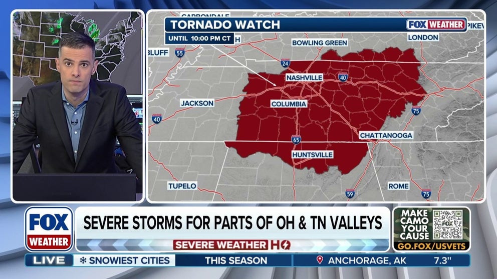
FOX Weather’s clip-driven update spotlights radar visuals and short explainer segments that help lay readers see where storms are forming and how fast they’re moving. This format excels at communicating motion and timing—storm speed, direction, and the line’s leading edge—information that’s critical for people deciding whether to delay travel or secure loose outdoor items. It also tends to reinforce the difference between a broad watch and localized warnings, setting expectations for follow-up alerts later in the evening.
Tornado Watch Issued for Multiple Counties Until 10 P.M.
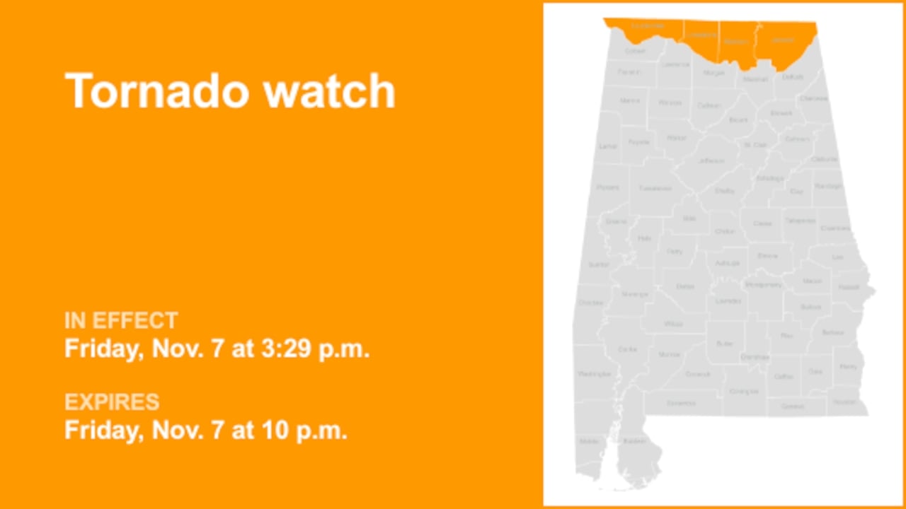
This brief highlights an end-time of 10 P.M., reinforcing that watches have windows that can be extended, trimmed, or replaced by warnings as storm behavior evolves. While less region-specific than local outlets, the piece adds a simple, memorable takeaway: evening hours remain the focus, so households should keep devices charged and avoid silencing alerts. In a fast-moving setup, concise reminders like these can be as useful as detailed meteorological discussion.
Summary / Insights
What ties the coverage together: timing (Friday evening), multi-state scope (TN/KY/AL), and evolving storm mode (discrete cells to line). Local outlets provide county-level context and practical readiness steps, while national and international coverage packages the story for broader audiences. The shared message: treat the watch as a proactive cue—know your shelter location, enable alerts, and avoid complacency as daylight fades.
- Most likely near-term outcome: scattered warnings as storms mature, with a damaging-wind threat even outside any tornado paths.
- Key uncertainty: how quickly storms organize into a line; earlier organization can expand wind damage but may reduce long-lived discrete tornadoes.
- What to watch: mesoscale updates from local NWS offices and whether watches are extended eastward into the late night.
TL;DR
A Tornado Watch covers parts of Tennessee, Kentucky, and Alabama this evening. Stay alert, charge devices, review your safe place, and follow local warnings as storms move in.

Internal link: none yet

Resources
Sources and references cited in this article.