Winter Strikes Back: Sluggish Spring Leaves Alaska Bracing for 18 Inches of Fresh Snow
The transition to spring has hit a frozen wall across Alaska as a series of powerful storms prepares to dump massive snow totals across the Interior and coastal regions. While most of the continent is eyeing blooming flowers, Alaskans are digging out parkas for a weekend that looks more like January than late April. A major weather system is now confirmed to bring up to 18 inches of snow and 45 mph wind gusts to several key areas.
How Events Unfolded
The current weather pattern began shifting late last week as a sequence of low-pressure systems lined up over the Pacific, ready to march across the state. What started as a sluggish spring transition quickly escalated when meteorologists identified a moisture-rich 'atmospheric train' heading for the Interior. By Monday, local reports confirmed that the typical thaw has been effectively paused.
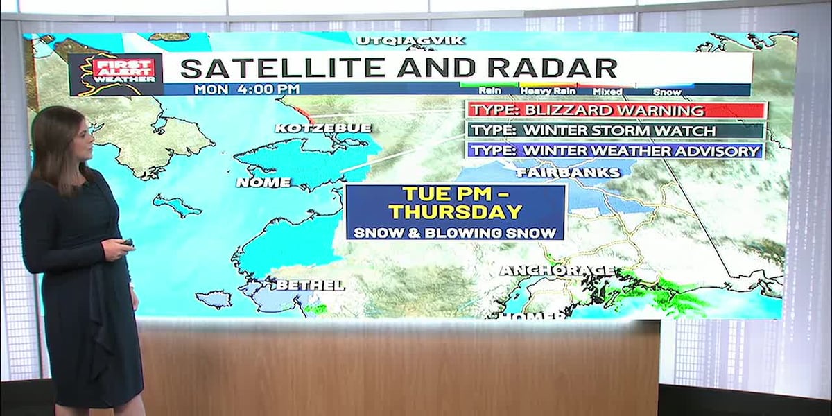
A critical Winter Storm Warning has been issued for 18 cities, stretching from the central Interior down toward the coastal mountain ranges. Forecasters are warning of 'very hazardous' conditions, particularly on the parks and Richardson highways where visibility is expected to drop to near zero during the peak of the storm. Winds gusting up to 45 mph are likely to create significant drifting, making some rural roads impassable by Saturday evening.
Meanwhile, the Kenai Peninsula has seen a slight shift in threats. While a flood advisory was recently canceled, the region remains under the influence of this broad, unstable air mass. The primary concern has moved from rising water to the sheer volume of incoming precipitation, which is increasingly falling as heavy, wet snow rather than rain.
The Fine Print
Why is this happening so late in the season? The culprit is a stubborn jet stream pattern that has trapped cold, Arctic air over the North Pacific, preventing the usual warm-up from reaching the northern latitudes. This 'blocking' pattern means that instead of one quick storm, Alaskans are facing multiple waves of energy.

For those living in the Interior, this isn't just a minor inconvenience. The heavy weight of late-season snow—which is often wetter and denser than mid-winter powder—poses a serious risk to power lines and structures. Historically, similar April 'snow dumps' in 1992 and 2013 led to widespread outages as ice-laden branches snapped under the pressure. It’s a classic case of nature’s last stand before the inevitable 'breakup' season begins in earnest.
The Response
Emergency management officials are urging residents to stay off the roads unless absolutely necessary. The National Weather Service emphasizes that the combination of heavy accumulation and high winds creates a recipe for isolation in remote communities.
The combination of heavy snow and high winds will make travel very hazardous to impossible in some areas. This is a significant late-season event.
Travelers in the region are being told to keep winter survival kits in their vehicles, a reminder that mother nature doesn't check the calendar. Local utility crews have already been placed on standby, anticipating that the 40-45 mph gusts will inevitably cause some grid instability as trees already weighed down by previous storms finally give way.
Putting It in Perspective
For Alaskans and those traveling to the state, the immediate ripple effect is a complete halt to early-season construction and outdoor commerce. The delayed 'breakup'—the time when river ice thaws and moves—could lead to a more condensed flooding season later in May, as the 18 inches of new snow will eventually have to melt all at once. This 'sluggish spring' creates a dangerous bottleneck for the state's hydrological cycle.
There’s also the human element. After a long winter, the psychological impact of a massive April storm can be draining. However, as the old saying goes, 'April snow is the poor man's fertilizer,' and for the local ecosystem, the extra moisture might provide a necessary buffer against an early wildfire season—silver linings in a very white landscape.
Looking Ahead
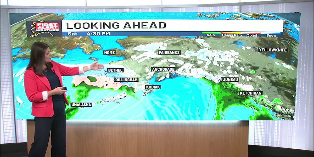
The primary storm front is expected to peak between Friday evening and Sunday morning. Once this system clears, long-range models suggest a brief stabilization, but temperatures are expected to remain 10 to 15 degrees below average through the end of the month. Anyone planning travel via the Parks Highway should expect delays and check KTVF Fairbanks for the latest road condition updates.
FAQ
Which cities are under the Winter Storm Warning?
The warning covers 18 cities across the Interior and Southcentral regions, including areas near Fairbanks, the Mat-Su Valley, and the coastal mountains where 18 inches of snow is possible.
How high will the wind gusts get?
Forecasts indicate winds will reach between 40 and 45 mph. This will likely cause significant blowing and drifting snow, reducing visibility on major highways to near zero.
Why is the flood advisory on the Kenai canceled?
The immediate threat of river flooding has subsided as temperatures dropped, causing precipitation to fall as snow rather than rain, which temporarily holds the water in place rather than contributing to runoff.
Is this amount of snow normal for late April?
While not unheard of, 18 inches is a significant anomaly for this time of year. Most years see 'breakup' and thawing by mid-April, making this a particularly sluggish spring transition.

Resources
Sources and references cited in this article.