Alaska megatsunami: the 1,578-foot wave rewriting climate risk maps
Scientists are still unpacking the sheer scale of what happened in Alaska, but the implications are already reaching far beyond the United States. For readers in GB, especially those booking Arctic cruises or tracking climate-driven disasters, this story lands close to home. A colossal tsunami triggered by a landslide in Alaska's Tracy Arm fjord has now been confirmed as the second-largest ever recorded, with waves surging nearly 1,600 feet up surrounding cliffs. Researchers say melting glaciers and unstable mountain slopes are making these events more likely.
Behind the Headlines
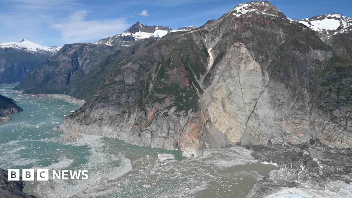
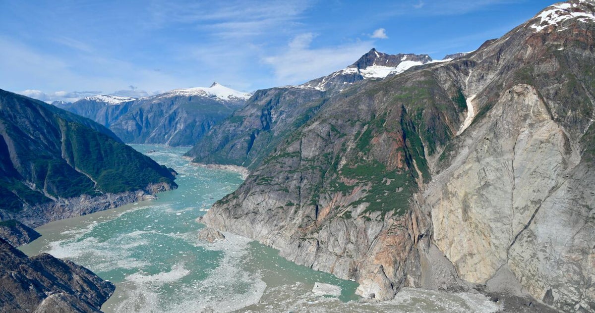
The disaster unfolded in one of Alaska's isolated glacial fjords, where steep mountains rise sharply from icy water. Researchers believe a huge section of rock and debris collapsed into the fjord after weakened glacier support gave way. The result? A wall of water reaching an estimated 1,578 feet — taller than the Empire State Building.
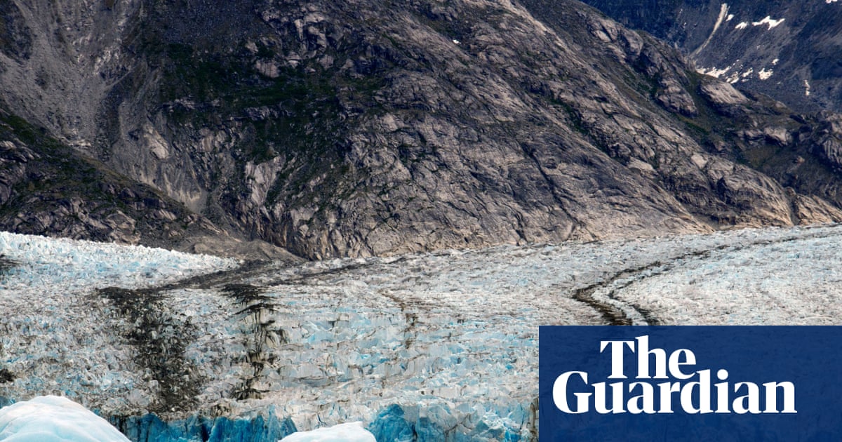
What's striking is how closely scientists are linking the event to climate change. As glaciers retreat, they stop supporting the mountain slopes beside them. Over time, those slopes become unstable. In simple terms, the ice had been acting like a brace. Remove the brace, and entire mountainsides can fail.
If you're following the growing debate around extreme weather and climate adaptation in Britain, this fits a wider pattern. From Alpine landslides to Greenland ice melt, researchers are increasingly warning that warming temperatures are reshaping landscapes in unpredictable ways. It's a bit of a wake-up call, really.
Here's What Happened
The landslide reportedly sent millions of cubic metres of rock crashing into the water in seconds. Scientists later mapped the enormous water run-up along the fjord walls, confirming the tsunami surged hundreds of metres above sea level.
Unlike ocean-wide tsunamis caused by earthquakes, this one remained mostly confined inside the fjord system. That limited wider casualties but created devastating local force. Experts compared the wave height to a skyscraper collapsing sideways into the sea.
Meanwhile, cruise operators are paying close attention. Alaska's fjords attract thousands of British tourists every year, particularly during summer Arctic voyages. Scientists warned that some shipping routes could face increased danger if unstable slopes are not monitored more aggressively.
One research team even created a digital recreation allowing people to virtually ride a jet ski through the tsunami zone. It sounds dramatic — because it is. But the aim is serious: helping emergency planners and the public visualise what these giant waves actually look like.
Voices & Opinions
Geologists involved in the research said the event initially surprised even experienced scientists because of the wave's extraordinary height. Several teams later confirmed measurements independently using satellite data and field surveys.
This was an exceptionally large landslide-triggered tsunami, and the evidence left behind was remarkable.
Climate experts argue this should not be treated as a one-off curiosity. They say warming regions near glaciers are entering a new era of geological instability. And here's the thing: many of these vulnerable areas also happen to be popular tourist destinations.
As glaciers retreat, they can leave steep valley walls unsupported and prone to collapse.
The Bigger Picture
The immediate impact may have been isolated geographically, but the wider consequences are global. Arctic tourism is booming, including from the UK, and cruise operators now face fresh scrutiny over route safety and evacuation planning.
There's also a financial angle. Monitoring remote glacier regions is expensive, yet disasters like this could become more common. Governments and insurers alike are starting to realise that climate risks are not only about storms and floods. Entire mountain systems are shifting.
For Britain, the story also feeds into ongoing conversations around coastal resilience and climate preparedness. Different geography, yes — but similar questions. How ready are communities and industries for environmental changes that no longer fit historical patterns?
You might be wondering whether these giant tsunamis threaten the UK directly. They do not in the same way. But the science behind them — melting ice destabilising landscapes — is part of the same global climate system affecting weather, coastlines and infrastructure everywhere.
The Road Ahead
Scientists are now pushing for better early-warning systems in glacier-heavy regions. Satellite monitoring, drone mapping and AI-powered slope analysis are all being explored to spot unstable terrain before disaster strikes.
Further studies are expected later this year as researchers continue analysing data from the Alaska event. Cruise operators and local authorities are also reviewing safety procedures for remote fjord travel.
FAQ
What caused the Alaska megatsunami?
A massive landslide crashed into a narrow fjord, displacing huge volumes of water.
How tall was the tsunami?
Scientists estimate the wave reached about 1,578 feet, making it the second-largest recorded.
Was anyone killed?
No major casualties were reported because the area was remote and sparsely populated.
Why are glaciers linked to this event?
Retreating glaciers can destabilise nearby mountain slopes by removing ice support.
Could this affect British tourists?
Potentially, yes. Alaska cruises are popular with UK travellers, and operators may reassess routes and safety plans.
Are giant tsunamis becoming more common?
Scientists believe climate-driven glacier retreat could increase landslide risks in some regions.

Resources
Sources and references cited in this article.