Tropical Cyclone Horacio Intensifies Into Category 5 Storm in Indian Ocean
Tropical Cyclone Horacio has officially intensified into a Category 5-equivalent storm over the Indian Ocean, marking the first time a storm has reached this peak intensity in 2026. The system reached this milestone on February 24 after undergoing a period of rapid intensification fueled by warm ocean temperatures. Currently, the storm is maintaining its strength as it traverses open waters, monitored closely by international meteorological agencies.

TL;DR
- Tropical Cyclone Horacio reached Category 5 intensity on February 24, 2026.
- It is the first storm of the 2026 calendar year to reach the highest level on the Saffir-Simpson scale.
- The storm is located in the Indian Ocean and has displayed a well-defined eye and extreme wind speeds.
- Meteorologists are tracking the system to determine potential impacts on landmasses or shipping lanes.
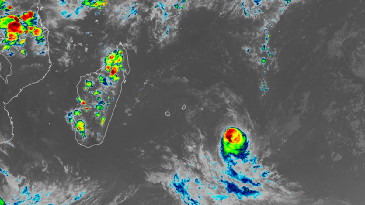
What Happened
Tropical Cyclone Horacio formed in the Indian Ocean in late February 2026. Following its initial formation, the system encountered favorable atmospheric conditions, including low wind shear and high sea-surface temperatures. By February 24, the storm successfully underwent rapid intensification, with sustained wind speeds exceeding 252 km/h (157 mph), officially classifying it as a Category 5-equivalent tropical cyclone. Satellite imagery captured a clear, symmetric eye surrounded by intense convection.
Key Developments
The intensification of Horacio was noted by Eumetsat and the Joint Typhoon Warning Center as it surpassed Category 4 status early on Tuesday. Official measurements confirmed that the central pressure of the storm dropped significantly during its peak phase. While the storm reached maximum intensity, it has remained primarily over open water, reducing immediate land-based casualties or structural damage reports. Weather agencies have designated it the strongest storm recorded globally so far in 2026.
Why This Matters
The development of a Category 5 storm in February serves as a significant indicator of high thermal energy in the Indian Ocean. As the first storm to reach this threshold in 2026, it provides critical data for climate researchers studying the frequency and intensity of tropical systems. Its rapid transition from a standard tropical storm to a major cyclone highlights the ongoing trend of extreme weather volatility.
What Happens Next
Meteorologists expect Cyclone Horacio to maintain its major hurricane strength for the next 24 to 48 hours before entering a region with higher wind shear or cooler waters. Forecast models are currently projecting a gradual weakening trend as the storm moves further south. Monitoring will continue to ensure any shifts in trajectory do not pose a threat to coastal regions or remote islands in the southern Indian Ocean.
FAQ
Is Cyclone Horacio expected to hit land?
Currently, the storm is tracking through open waters in the Indian Ocean. While no direct landfall is imminent for major continents, weather agencies are monitoring its proximity to island chains.
How strong is Tropical Cyclone Horacio?
Horacio reached Category 5-equivalent status, which involves sustained winds of 157 mph or higher. It is currently the most powerful storm of the 2026 season.
What caused Horacio to intensify so quickly?
The storm benefited from exceptionally warm ocean temperatures and low vertical wind shear. These factors allowed the system to organize quickly and develop a powerful internal structure.
When did Horacio become a Category 5 storm?
The storm reached its peak Category 5 intensity on February 24, 2026. It moved up from Category 3 status in less than 24 hours.