
Massive walls of blowing dust advanced across south-central and southeastern Arizona, cutting roadway visibility to less than a quarter of a mile and driving wind gusts upward of 65 mph through the Phoenix metropolitan area. The dramatic monsoon downdrafts knocked down mature trees, damaged high school roof infrastructure in Tempe, and triggered emergency warnings across Maricopa, Pinal, and Pima counties. As the storms collided with triple-digit desert heat reaching 113 degrees, state transportation officials urged motorists to take immediate precautions.
The Story at a Glance
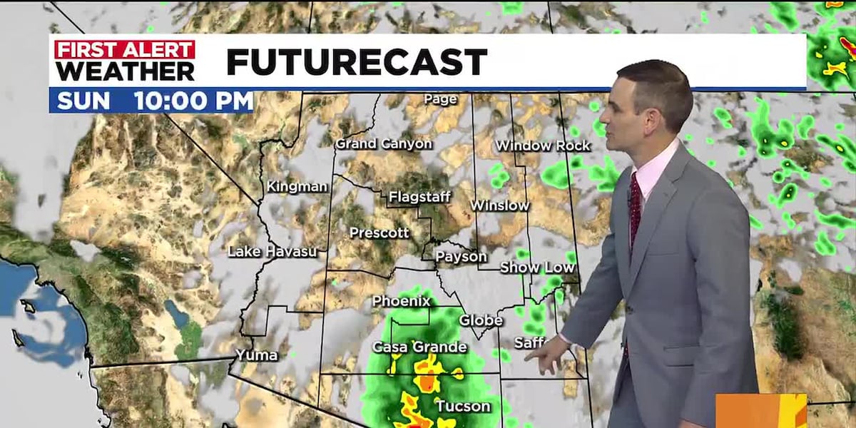
Intense thunderstorm complexes developing east and southeast of Greater Phoenix unleashed powerful outflow boundaries that traveled west-northwestward across the desert floor. In central Pima County, wind speeds topped 50 mph along Route 86 and Route 286, while radar tracking confirmed a dust front moving through Fountain Hills, Piestewa Peak Park, and Phoenix International Raceway at speeds between 30 and 35 mph. Rain accumulations varied dramatically from 0.35 inches in Fountain Hills to 1.30 inches in localized East Valley corridors, with Phoenix Sky Harbor International Airport recording 0.56 inches alongside severe reductions in airfield visibility.
How the Story Developed
Atmospheric instability surged as weather balloon soundings from the National Weather Service recorded Mixed-Layer Convective Available Potential Energy (MLCAPE) and Downdraft CAPE (DCAPE) values around 1700 J/kg, creating an environment ripe for damaging straight-line winds. The Storm Prediction Center issued a Severe Thunderstorm Watch encompassing south-central and southeastern Arizona as storm cells rapidly expanded.

As convective downdrafts slammed into the heated ground, dense dust walls lifted thousands of feet into the air. In Tempe, severe winds tore away structural roof sections at Marcos De Niza High School. In Chandler, uprooted trees blocked corridors near Dobson and Warner roads, while heavy limbs collapsed onto carports around North 7th Street and Bell Road in Phoenix. Additional outflow boundaries continued to trigger blowing dust advisories and push toward Queen Creek and Pinal County at 25 mph.
Key People and Details
Meteorologists tracking the severe systems noted that cold air plunging out of thunderstorm cores rapidly mobilizes loose surface soil across desert terrain.
Motorists should not drive into a dust storm. PULL ASIDE STAY ALIVE!

The term haboob translates from Arabic to mean 'big, blasting winds,' according to Andrew Deemer, an NWS Phoenix meteorologist and former linguist. Meteorologist Ryan Worley of the National Weather Service noted that the primary hazard for Valley residents remains severe winds capable of snapping utility poles and uprooting trees before outflows wash out.
- Haboob
- A massive, rapid dust storm formed when convective downdrafts from thunderstorms strike the dry desert floor, lifting loose earth into a towering wall of suspended particles.
- Outflow Boundary
- A dense front of cold, downdraft-cooled air rushing outward from a thunderstorm cluster that can initiate new storms and lift surface dust.
Reaction and Response
The Arizona Department of Transportation reiterated its safety protocols via the Pull Aside, Stay Alive campaign, cautioning motorists against stopping in active travel or emergency lanes. State guidelines instruct drivers caught in zero-visibility conditions to exit the roadway entirely, turn off all vehicle lights to prevent tailgating collisions, engage the emergency brake, and keep seat belts fastened until dust clears.
What to Watch
Extreme Heat First Alert warnings remain active across the Valley through Saturday, Aug. 29, with afternoon high temperatures hovering between 110 and 114 degrees. While lower desert elevations face a temporary downturn in thunderstorm frequency, scattered showers and isolated storms will persist over the high country and the White Mountains. Extended 30-day forecast models continue to monitor moisture drawing from the Gulf of California for potential late-monsoon relief in September.
Frequently Asked Questions
What causes a haboob to form in the Arizona desert?
Haboobs form during the summer monsoon season when cold downdrafts inside strong thunderstorms collapse toward the ground. Upon hitting the dry desert basin, this cold air rapidly pushes outward in all directions, scooping up dry topsoil and propelling it forward as a dense, high-altitude wall of blowing dust.
How long do haboob dust storms typically last?
The leading wall of dust usually sweeps past a specific location within several minutes up to an hour. Lingering dust particles and reduced visibility, however, can remain suspended in the air for longer periods if multiple outflow boundaries converge across the metro area.
What should drivers do if caught in a sudden dust storm?
Drivers should check surrounding traffic, slow down immediately, and exit the highway if possible. If unable to exit, pull completely off the paved roadway, set the parking brake, turn off all vehicle lights so trailing vehicles do not follow your path into a collision, and keep seat belts fastened.
Where did the structural damage occur during the recent storms?
Severe winds exceeding 60 mph caused partial roof damage across several sections of Marcos De Niza High School in Tempe, alongside numerous downed trees and collapsed carport covers in Chandler and North Phoenix.