
The afternoon sky over South Jersey turned an ominous, pitch black just before the heavens opened up, transforming neighborhood streets into rushing, debris-filled rivers within minutes. Drivers climbed out of sinking car windows while shop owners watched helplessly as murky water breached their doorways. A slow-moving, powerful thunderstorm trapped Camden City and Camden County in a severe storm cycle, dropping more than 4 inches of rain in just over an hour to trigger the worst localized flooding the area has seen in decades.
How Events Unfolded
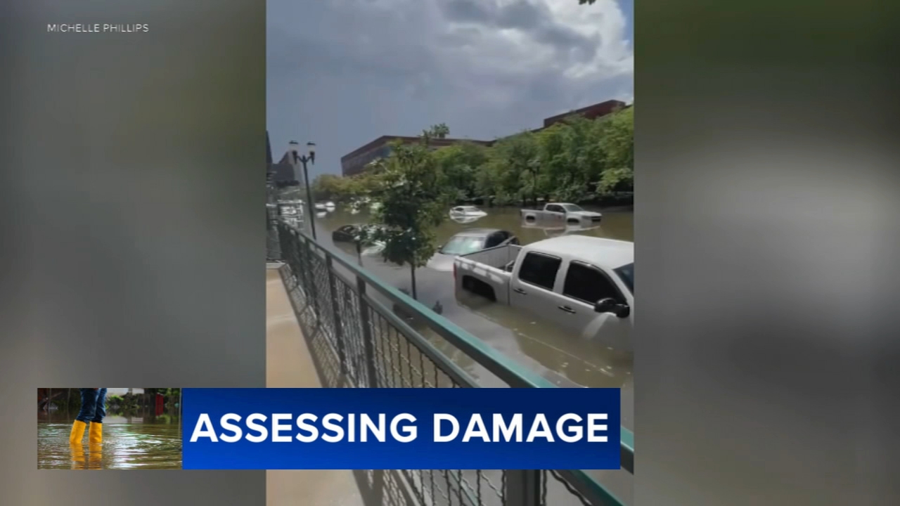
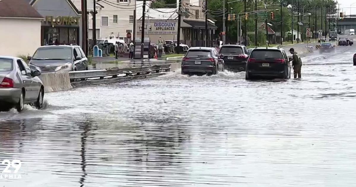
The deluge began suddenly on Monday morning, quickly overwhelming regional infrastructure. Between 10 a.m. and noon, the Camden County Dispatch Center was overwhelmed by nearly 1,000 emergency 911 calls. Torrential rain rapidly inundated major transit corridors, completely shutting down highways and byways, including Admiral Wilson Boulevard and portions of Route 30 near the Ben Franklin Bridge, bringing traffic to a complete standstill.
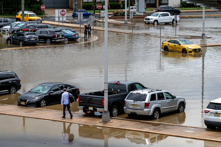
As the water rose, dozens of motorists found themselves stranded in their vehicles. Local emergency responders deployed specialized tactical equipment, including a newly acquired high-water rescue vehicle named High Water One, to safely pull 14 individuals from flooded streets. Across Camden County, emergency personnel executed more than 40 water rescues. Despite the widespread chaos and significant vehicle damage, municipal officials confirmed that no injuries were reported.
In the residential neighborhoods, the aftermath required non-stop emergency cleaning. Residents spent hours using wet vacuums and brooms to clear out flooded garages and basements. The severe water damage also forced the temporary closure of local public infrastructure, including the Nilsa I. Cruz-Perez Downtown Camden library branch, which will remain closed for the rest of the week.
Under the Surface
Local authorities pointed to a unique combination of environmental conditions that made the flooding so severe. Camden County officials described the situation as a perfect alignment of high ground saturation levels, an elevated water table, and a concurrent high tide. When nearly 4 inches of rain fell in roughly an hour, the city's storm drainage and sewer systems were instantaneously overwhelmed.
The disaster has brought broader regional economic vulnerabilities to light. A concurrent report from the Poverty Research Institute of Legal Services of New Jersey reveals that true poverty in the state impacts closer to 3 million residents—three times higher than official federal figures of 859,000. In Camden County, the true poverty rate sits at a staggering 38%, meaning a significant portion of the affected community lacks the financial buffer to easily recover from sudden property or vehicle losses.
Voices & Opinions
The sheer scale of the storm surprised even veteran emergency personnel who navigated past historic disasters. Camden Fire Chief Jesse Flax noted the historic nature of the cloudburst.
I’ve never seen this in my whole career. I’ve seen bad fires, I’ve seen a lot of different things. But I’ve never seen it flood in this capacity.
Business owners expressed deep frustration over recurring infrastructure failures. Tony Morelli, who operates a 75-year-old corner market in Gloucester Township, noted that his business floods three to eight times every summer due to overwhelmed storm drains, costing him thousands of dollars in ruined equipment. Meanwhile, small shop owners like Daniel Duran of JYM Supermarket on Haddon Avenue had to actively pump water from basements while keeping doors open to survive economically.
Putting It in Perspective
New Jersey Governor Mikie Sherrill visited Camden on Tuesday to inspect the damage and thank first responders. Sherrill used the platform to connect the extreme weather event to new legislation targeting commercial data centers, which she signed in Salem County just hours prior. The bills create a separate utility ratepayer class for data centers, ensuring they pay for their own energy upgrades and are the first to be restricted during emergencies to avoid straining the local power grid during major storms.
The American Red Cross established local operations in Camden, distributing essential cleaning supplies including mops, bleach, gloves, and tarps to impacted families trying to salvage their belongings.
Looking Ahead
State and city leaders are urging all affected residents and business owners to formally report property damage to the New Jersey Office of Emergency Management. Collecting this localized data is necessary for the state to calculate totals and meet the strict federal thresholds required to request formal disaster assistance.
The relief may be short-lived, as the National Weather Service warns that more severe weather is on the horizon. Forecasters indicate that isolated showers will turn into widespread storms by Friday, carrying a marginal threat for damaging winds and additional heavy downpours that could trigger a secondary round of flash flooding across Central and South Jersey before drying out by Sunday.
Frequently Asked Questions
How much rain fell during the Camden flash flood?
Camden received more than four inches of rain in a little over an hour during the peak of Monday's storm.
How many people required water rescue in Camden?
Emergency responders rescued 14 people directly from the streets of Camden City, contributing to over 40 water rescues across Camden County.
Where can Camden residents report storm damage?
Residents can contact the Emergency Operations Center at 856-757-7132 or 856-757-7139 to report property damage and request support.
Are the public libraries in Camden open?
The Nilsa I. Cruz-Perez Downtown Camden library branch is heavily damaged and will remain closed for the rest of the week.
Is there a threat of more flooding in New Jersey this week?
Yes, the National Weather Service has forecasted another round of showers and thunderstorms for Friday that could cause additional flash flooding.