Tropical Cyclone Horacio Becomes Earth’s First Category 5 Storm of 2026
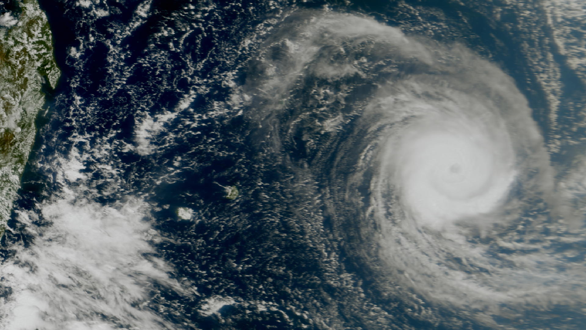
Tropical Cyclone Horacio has intensified into a powerful Category 5 system in the Indian Ocean, marking the first time a storm has reached this intensity globally in 2026. The storm is currently located east of Mauritius and is moving through the central Indian Ocean basin. Satellite imagery confirms that the system has developed a well-defined eye and extreme sustained wind speeds.

TL;DR
- Horacio reached Category 5 status on February 24, 2026.
- It is the strongest tropical cyclone recorded globally so far this year.
- The storm is currently positioned in the Indian Ocean, east of Mauritius.
- Meteorological agencies are monitoring its trajectory for potential land impacts.
What Happened
Tropical Cyclone Horacio underwent rapid intensification over the warm waters of the Indian Ocean during late February 2026. By February 24, meteorological data confirmed that the storm’s central pressure had dropped significantly, allowing it to reach Category 5 intensity on the Saffir-Simpson scale. This development occurred while the system was situated to the east of Mauritius, making it the most significant weather event in the region for the current season.
Key Developments
The system was first identified as a tropical depression before quickly escalating through the tropical storm and cyclone stages. Official satellite data from EUMETSAT and Meteosat-9 captured the formation of a symmetrical eye wall, a hallmark of high-intensity storms. Current tracking indicates that while the storm is exceptionally powerful, its core remains over open water, though its outer bands are influencing regional maritime conditions.
Why This Matters
Horacio represents a significant milestone in the 2026 cyclone season as the first storm to reach the maximum intensity tier. Its rapid development provides critical data for meteorological models tracking Indian Ocean climate patterns. For Australia and neighboring Indian Ocean territories, the presence of such a high-intensity system necessitates heightened maritime awareness and monitoring of potential shifts in atmospheric steering currents.
What Happens Next
Meteorologists expect Horacio to maintain its intensity for a brief period before encountering cooler waters or increased wind shear. Regional weather bureaus will continue to issue regular updates on its coordinates and projected path. There is currently no immediate landfall predicted for major populated landmasses, but maritime warnings remain in effect for the central Indian Ocean.
FAQ
Is Tropical Cyclone Horacio hitting Australia?
Currently, Horacio is located in the central Indian Ocean, far to the west of the Australian mainland. While it is being monitored by regional stations, there is no current forecast indicating a direct impact on the Australian coast.
How strong is Cyclone Horacio right now?
As of February 24, 2026, Horacio has reached Category 5 status, the highest level on the tropical cyclone scale. It features sustained winds exceeding 252 km/h.
Where is the storm located?
The storm is situated in the Indian Ocean, specifically positioned to the east of Mauritius and Reunion Island. It is moving through open waters in a generally southward or southwestward direction.
What is the official name of the storm?
The storm is officially designated as Tropical Cyclone Horacio. It is the first system to reach Category 5 strength globally in the 2026 calendar year.
Are there any evacuation orders?
No evacuation orders have been issued for major landmasses at this time. Authorities in Mauritius and nearby islands are advising residents to monitor weather updates as the storm passes to their east.