Last updated: November 6, 2026
Record Flood Crest Along Ocoee Triggers Emergency Declarations and Sweeping Rescues
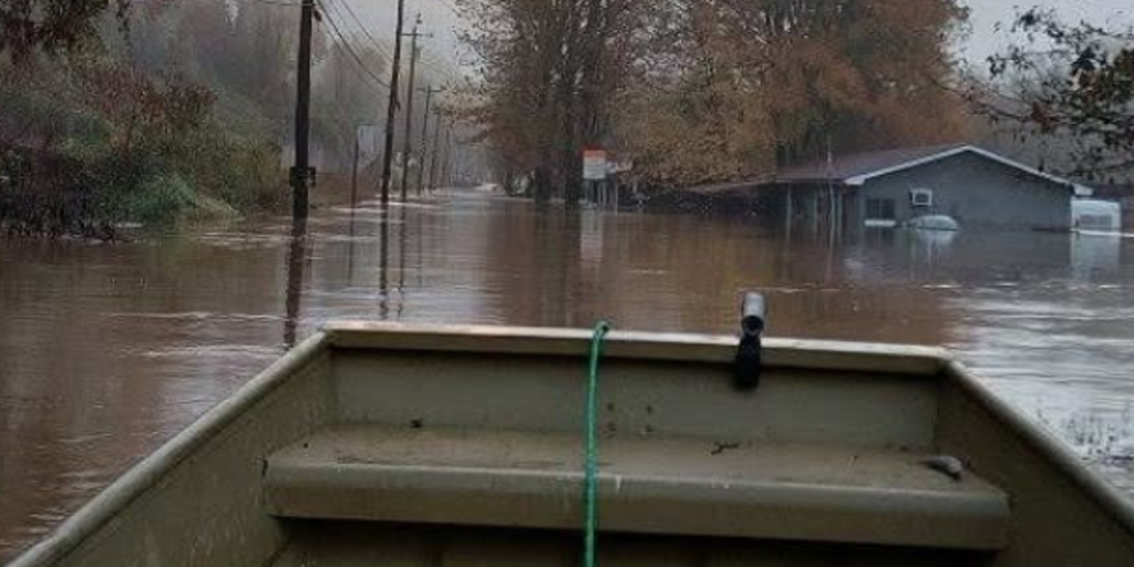
Water along the Ocoee River crested at an unprecedented 18 feet on Thursday morning, smashing an all-time record set in 1990 and unleashing widespread flash flooding across the Tennessee-Georgia border. More than 10 inches of rain fell across northern Georgia within hours, trapping residents on roofs and stranding drivers as creeks and rivers overwhelmed valley communities. The sudden surge prompted simultaneous municipal and state emergency declarations as emergency crews navigated inundated town centers to pull over 140 people to safety.
What Was Decided
Faced with catastrophic runoff and submerged infrastructure, local and state officials moved rapidly to establish statutory disaster authority. Georgia Governor Brian Kemp declared a state of emergency across four northern counties: Fannin, Gilmer, Murray, and Union. Across the state line, Tennessee's Polk County declared a matching emergency after the National Weather Service Morristown office confirmed the historic 18-foot crest, which broke the previous 1990 threshold of 17.75 feet.
Municipal leaders took immediate protective action. In Georgia, the City of McCaysville declared a state of emergency shortly after 5 a.m., shutting the city down to all non-emergency traffic. In Tennessee, Copperhill municipal leadership mirrored that decision, sealing off the central business district. The emergency status authorized multi-agency deployments across county lines, bringing in the Tennessee Emergency Management Agency, Georgia Department of Natural Resources, and dozens of regional mutual-aid units to handle water rescues and secure vulnerable utility infrastructure.
What the Policy Requires
The emergency declarations immediately activated state emergency operations plans, mobilizing localized asset sharing and municipal shutdown mandates. The City of McCaysville closed access to Blue Ridge Drive at the bridge along with the Steel Bridge, while emergency personnel set up the county recreation center as a primary evacuation shelter. In Polk County, highway officials shut down the Rogers Creek Bridge on Grassy Creek Road after a large structure broke free from its foundation and struck the crossing.

Regulatory protocols shifted rapidly toward public health mandates. McCaysville municipal officials issued an immediate boil water advisory across the community after floodwaters disabled the municipal treatment works. To manage public safety amidst downed power lines and ruptured services, city ordinances prohibited unauthorized access to downtown commercial districts while Tennessee Valley Authority engineers executed emergency dam releases at 150,000 gallons per second from the Ocoee 3 Dam in Copperhill.
Who Will Be Affected
The immediate brunt of the storm fell on residents in McCaysville and Copperhill, where homes and storefronts took on several feet of water. Mutual aid teams rescued at least 80 people in Fannin County and another 68 people in Polk County, utilizing swiftwater boats and aerial support. Both the Tennessee and Georgia National Guard systems and state patrol aircraft deployed helicopters on standby to lift trapped residents from residential rooftops.
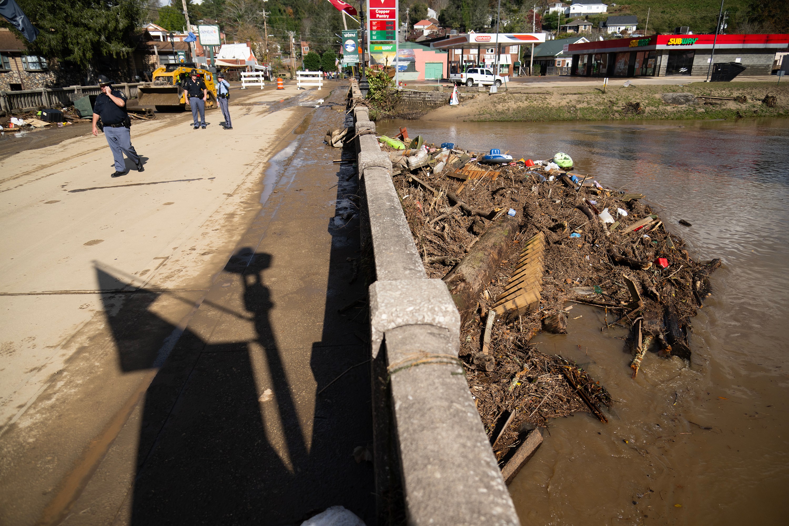
Commercial damage is widespread across the twin border towns. In McCaysville, lightning ignited at least six structure fires during the storm, and flooding triggered a business propane tank explosion that injured a responding firefighter. Business real estate across the basin took direct inundation as surface runoff poured down Harper Town Hill into downtown corridors, forcing regional school closures across both Fannin County and Polk County.
Support and Criticism
First responders earned broad praise for rapid deployment under harrowing conditions. The multi-jurisdictional Tri-State Mutual Aid Swiftwater network pulled personnel from dozens of municipal departments, including Cleveland, Chattanooga, East Ridge, Athens, Dallas Bay, and McMinn County, alongside specialised drone units from Hamilton and Rhea counties.
However, local commercial proprietors noted the sheer scale of property destruction will challenge local resilience for months. Copperhill business owner Jodie Nicholson highlighted the impending economic toll:
I think when it comes to the destruction of items and products and buildings and real estate, I think that’s gonna be the big issue down there and it’s gonna take a lot of people coming together to try to remediate the situation
While the Tennessee Valley Authority explained that it had been holding back floodwaters upstream in Blue Ridge since November 3 to mitigate peak downstream flow, operators eventually had to spill massive volumes through Ocoee 3 Dam to protect the reservoir integrity, compounding river levels below.
What Happens Next
Recovery operations are focusing on basic life support and critical infrastructure assessments. The City of McCaysville scheduled emergency potable water distribution behind City Hall for Friday, November 6, operating between 9 a.m. and 5 p.m., as public utility officials confirmed they cannot yet provide an estimated date for water system restoration.
Civic organizations, led by the Ocoee Country Chamber of Commerce, established central donation sites at their Benton office and the Jackie Rogers County Clerk’s office to gather baby formula, diapers, wipes, and meals. Meanwhile, structural engineers and county road crews must inspect damaged bridges like the Rogers Creek crossing before travel arteries between Tennessee and northern Georgia can safely reopen.
Frequently Asked Questions
- How high did the Ocoee River crest during the flood?
- The Ocoee River crested at just over 18 feet on Thursday morning, surpassing the previous record of 17.75 feet set in 1990.
- How much rain fell to cause the flash flooding?
- Parts of North Georgia, specifically Gilmer and Fannin counties, received more than 10 inches of rain over several overnight hours, while Polk County received approximately 3 inches.
- How many people were rescued from the high water?
- Emergency personnel rescued at least 80 individuals in Fannin County, Georgia, and 68 people across Polk County, Tennessee.
- Why is there a boil water advisory in McCaysville?
- McCaysville's municipal water system was knocked completely out of operation by floodwater intrusion, leaving officials unable to verify drinkable water quality.
- Where can displaced residents receive clean water and supplies?
- McCaysville organized water distribution behind City Hall, while food and supplies are available at Luttrell’s Hardware in Copperhill and the Fannin County recreation center shelter.