
Scientists have uncovered two enormous tears beneath southeastern Iran's Arabian Plate and identified how tectonic activity near Japan helped accelerate the formation of the Gulf of California, offering new insight into the powerful underground forces that shape Earth's continents. The findings, reported in November 2026, connect geological processes thousands of miles apart and reveal how movements deep beneath the surface can influence landscapes over millions of years. For the United States, the research has particular relevance because the Pacific tectonic system involved in the second discovery also affects important geological regions, including the area around the San Andreas Fault and Cascadia.
What Was Achieved
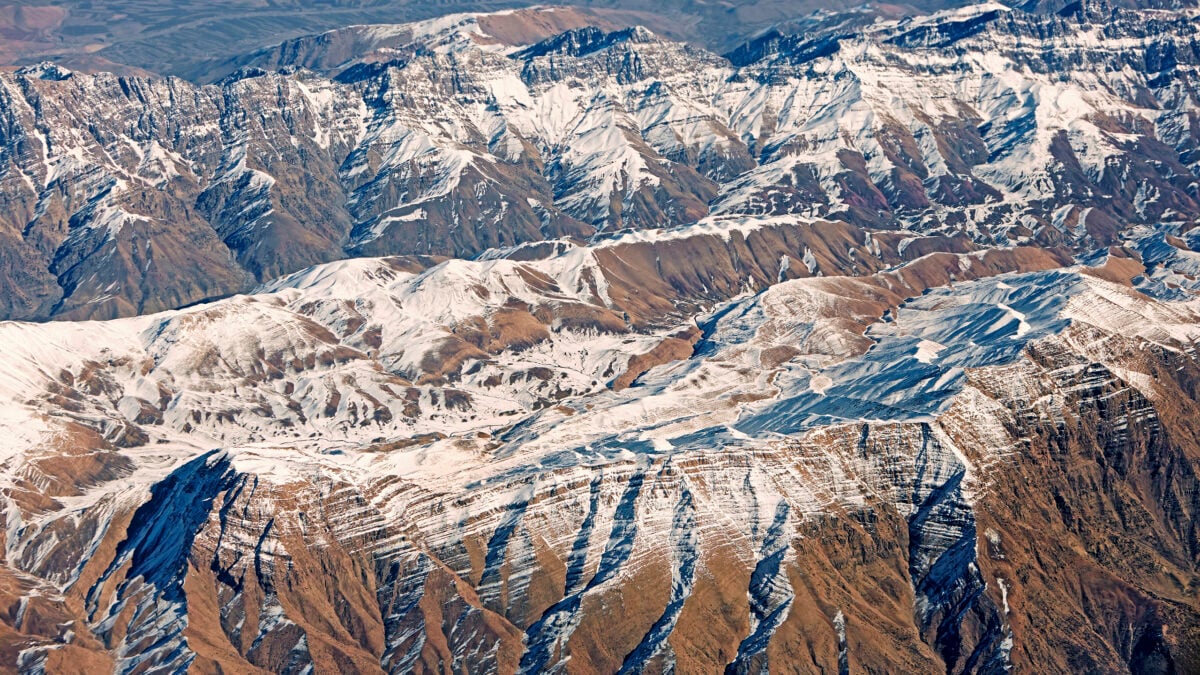
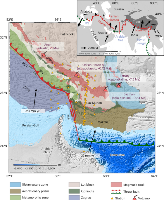
A research team led by scientists from the Chinese Academy of Sciences identified two substantial tears in the Arabian tectonic plate beneath southeastern Iran. Their findings, published in Nature Geoscience, provide evidence of two different forms of plate tearing occurring within the same geological region.
One rupture runs horizontally near the boundary between the Zagros collision zone and the Makran subduction zone. A second, smaller tear extends vertically closer to the surface near the Makran Trench. The researchers' models suggest that the two structures developed independently but could eventually join as the surrounding plate continues moving.
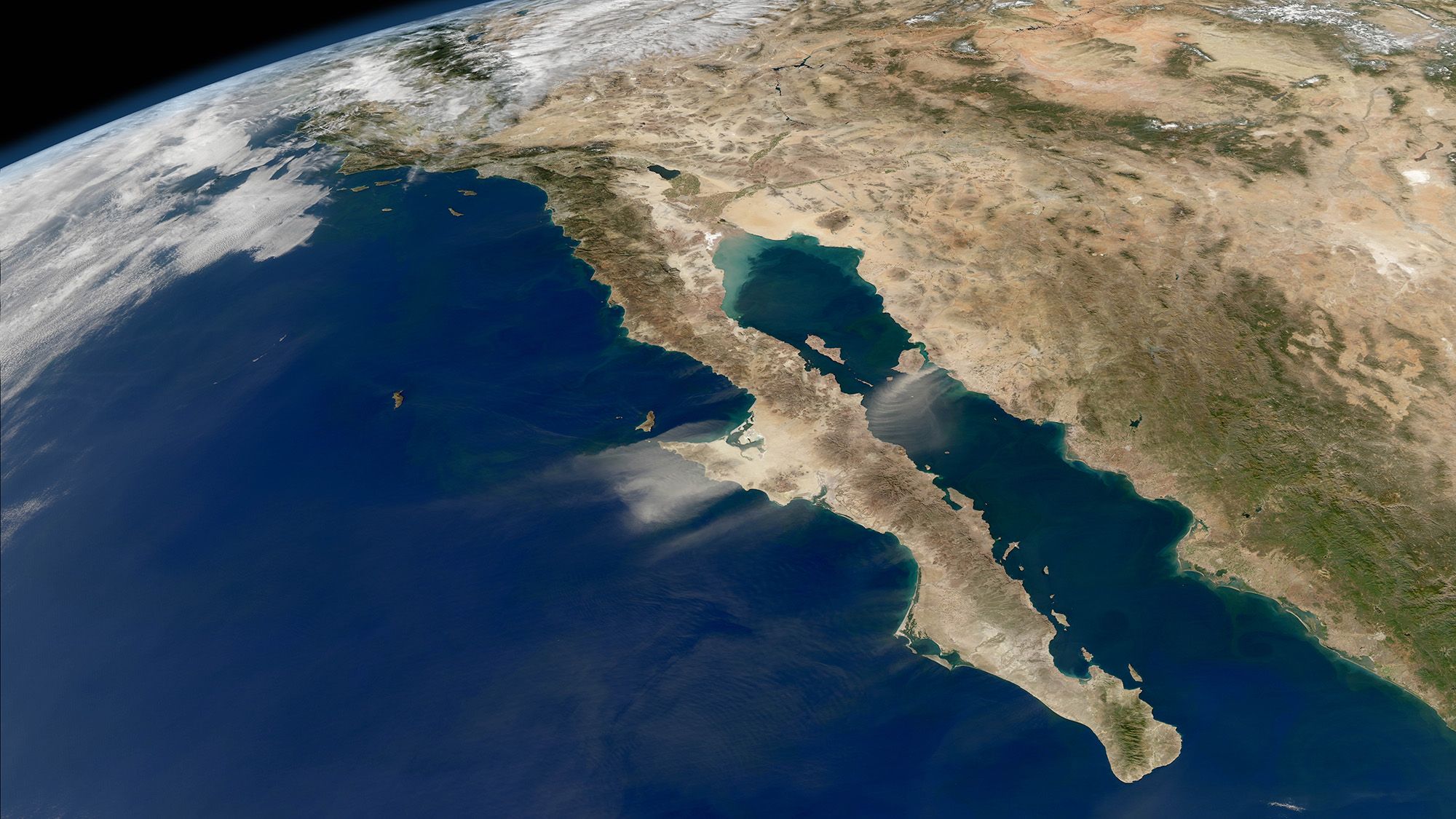
A separate study published in Science on October 29 examined how tectonic activity near Japan influenced the development of the Gulf of California. The research suggests that a change in subduction patterns thousands of miles away transmitted forces across the Pacific Plate, accelerating the separation of Baja California from mainland Mexico.
How It Works
The Iranian discovery involves two types of rock behaving differently as tectonic plates collide. Part of the Arabian Plate contains oceanic lithosphere, remnants of the ancient Neo-Tethys Ocean. Its basaltic rocks are relatively thin and dense, making them more likely to sink beneath an adjacent plate.
The neighboring continental lithosphere is thicker but less dense, with lighter, granite-like material. Rather than sinking as readily, it resists downward movement and contributes to mountain building when plates collide. This difference in physical properties creates conditions that can produce tearing within the descending plate.
The California research describes another mechanism. Near Japan, a single subduction zone divided into two separate zones approximately 10–12 million years ago. The resulting changes in tectonic pulling forces traveled through the Pacific Plate and influenced the region around Baja California.
This process contributed to rifting, in which continental crust stretches, thins and eventually separates. The Gulf of California formed as Baja California shifted onto the Pacific Plate.
What Has Been Demonstrated
For the Iran study, researchers analyzed seismic recordings collected between March 2017 and September 2018 from a network of 69 monitoring stations. These instruments detected vibrations generated by distant earthquakes. Because seismic waves travel at different speeds depending on the temperature and density of underground rocks, scientists could use the measurements to reconstruct structures deep beneath the surface.
The resulting observations indicated that oceanic lithosphere beneath the Makran region has descended to at least 450 kilometers. In the Zagros collision zone, continental lithosphere has descended no deeper than 300 kilometers. This contrast supports the researchers' interpretation of the two tearing processes.
The California findings were tested using a global plate tectonics model run on supercomputers at the Texas Advanced Computing Center. Researchers found that the additional tectonic influence from Japan helped explain why rifting in the Gulf of California progressed faster than expected under the alternative scenario examined in the study.
The reported rifting period was approximately 6–13 million years, compared with a typical range of 30–80 million years for such processes. The gulf itself formed approximately 6–8 million years ago.
What Problems It Could Solve
Understanding how tectonic plates tear, collide and separate can improve scientific models of Earth's geological development. The Iranian discovery offers researchers an unusually detailed opportunity to study the transition between oceanic subduction and continental collision. It also provides evidence that different tearing mechanisms can operate simultaneously within one region.
The California research has a more direct connection to North American geology. By demonstrating how tectonic forces can travel across an entire plate, it offers another way to investigate the development of plate boundaries and potentially hazardous seismic regions.
The researchers specifically identify the San Andreas Fault and the Cascadia subduction zone as areas where these findings could be relevant. Better understanding of the forces shaping these boundaries can help scientists refine geological models, although the studies do not provide new earthquake predictions or establish that a major earthquake is imminent.
For residents of the western United States, the distinction matters: research into long-term tectonic processes can improve understanding of regional geology, but it should not be confused with a forecast of when or where an earthquake will strike.
What Still Needs to Happen
The Iranian study leaves important questions about the future development of the two tears. Numerical models suggest that they may eventually merge, progressively consuming the section of continental-oceanic boundary between them. However, the process has unfolded over several million years, so the proposed connection is a geological prediction rather than an immediate event.
Researchers also want to understand how the ruptures could influence volcanic activity. The study indicates that hot magma may already be filling some of the spaces created by the tearing plates, making the relationship between underground deformation and magma movement an important subject for further investigation.
In the California case, additional work will be needed to examine how changes in mantle properties and tectonic stresses influence the development of plate boundaries. The researchers tested their model under different assumptions and reported that the central result remained consistent. Further geological observations can help establish how widely the mechanism applies to other regions.
Frequently Asked Questions
Where were the two tectonic tears discovered?
They were identified beneath southeastern Iran, within the Arabian Plate, near the Zagros collision zone and the Makran subduction zone.
How deep does the Arabian Plate extend beneath Iran?
The study estimates that oceanic lithosphere beneath the Makran region has descended at least 450 kilometers, while continental lithosphere beneath the Zagros zone has descended no deeper than 300 kilometers.
Could the two tears beneath Iran eventually join?
Yes. Researchers' geological models indicate that the independently formed tears may progressively extend until they eventually merge.
How did tectonic activity near Japan affect California?
A change that produced two subduction zones near Japan transmitted tectonic forces through the Pacific Plate, accelerating rifting in the Gulf of California.
Did tectonic activity help form the Grand Canyon?
The California study connects distant tectonic forces to the formation of the Gulf of California and the separation of Baja California. It also identifies the geological sequence through which the Colorado River later carved the Grand Canyon.
Do these discoveries predict future earthquakes in the United States?
No. The research improves understanding of long-term tectonic processes and geological structures, but it does not provide specific earthquake dates, locations or predictions.