Winter Storm Signals Stretch Across the U.S., From the Upper Midwest to the Deep South
A broad winter weather pattern is drawing attention across the United States as forecasts point to snow, ice, and bitter cold reaching regions with very different winter expectations. From lake-effect snow warnings in the Upper Midwest to cautious model-watching in Florida and Georgia, the current trend reflects how a single cold system can create sharply different local impacts. This digest examines how forecasters and communities are responding as uncertainty, timing, and regional vulnerability shape the national conversation.
Main Topic Overview
The developing winter storm trend is less about one single blockbuster snowfall and more about its geographic reach. Meteorologists describe a southward-dipping cold air mass interacting with moisture in multiple ways: heavy snow in northern counties, freezing drizzle and slick roads near the Great Lakes, and rare but headline-grabbing snow chances across the Southeast. Similar patterns have appeared in past winters, but the combination of widespread coverage and heightened public attention has made this episode notable.
News Coverage
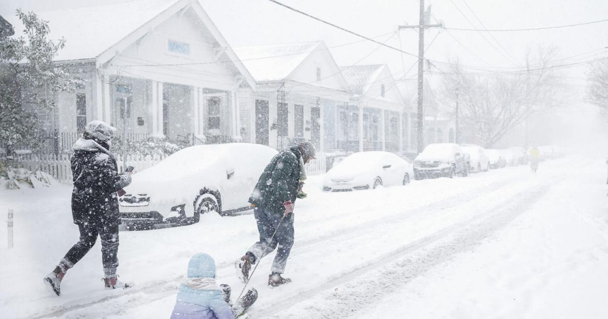
Winter storm warning issued for Iron County, up to inches of snow expected
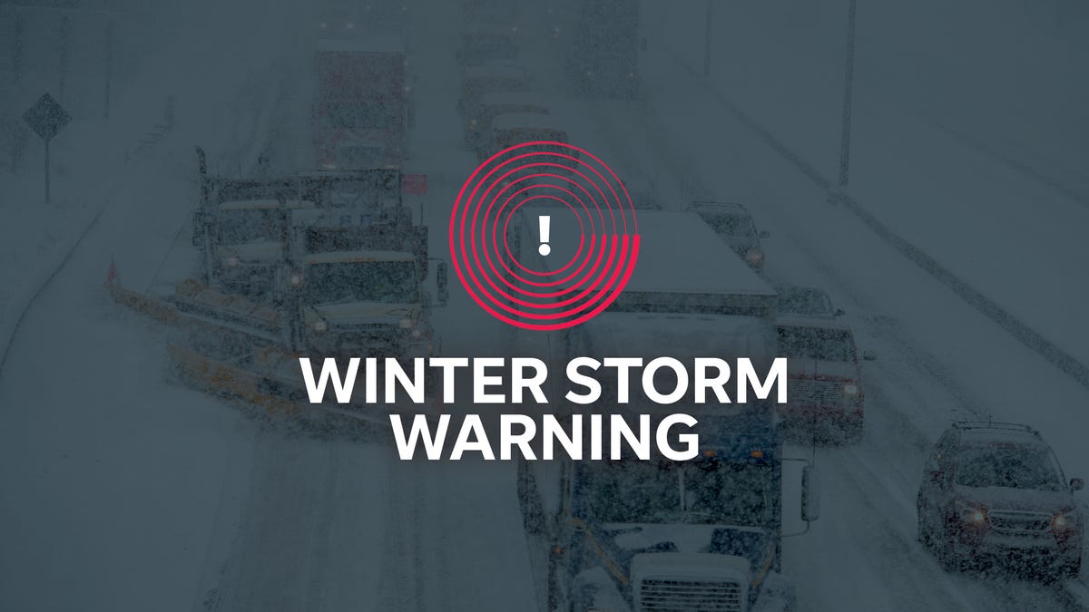
Forecasters issued a winter storm warning for Iron County as snowfall totals were projected to climb into ranges that could disrupt travel and daily routines. The coverage emphasizes preparation rather than surprise, noting that residents in northern Wisconsin are familiar with such systems but still face challenges when snow accumulates quickly. Officials highlighted timing over totals, explaining that concentrated snowfall windows often strain road crews. This report anchors the broader trend by showing how northern regions remain the most directly affected, even as attention spreads south.
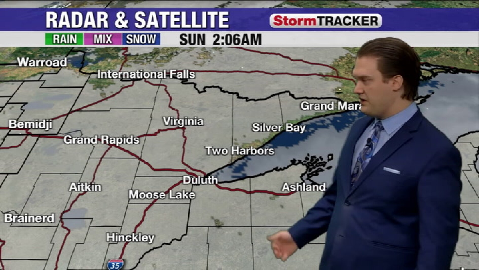
Duluth, MN Faces Wintry Mix, Freezing Drizzle Risk Tonight

In Duluth, attention shifted from heavy snow to the subtler risks of freezing drizzle and mixed precipitation. Meteorologists warned that even light ice accumulation could create hazardous road conditions, a reminder that winter impacts are not measured solely in inches of snow. The article situates Duluth within a familiar Great Lakes pattern where temperature fluctuations complicate forecasts. This perspective reinforces the idea that the current trend involves varied hazards, not a uniform storm experience.
Cloudy skies early, and timing out the chance for light snow today
This forecast focused on uncertainty and timing rather than intensity, explaining how marginal temperatures could limit snowfall despite favorable moisture. The coverage reflects a recurring theme this winter: small shifts in temperature making large differences in outcome. By emphasizing probability instead of certainty, the report illustrates how forecasters communicate risk in transitional systems. It complements heavier storm warnings by showing the quieter, day-to-day forecasting challenges within the same pattern.
Tracking in a wintry mix with flurries and slick spots by tomorrow morning
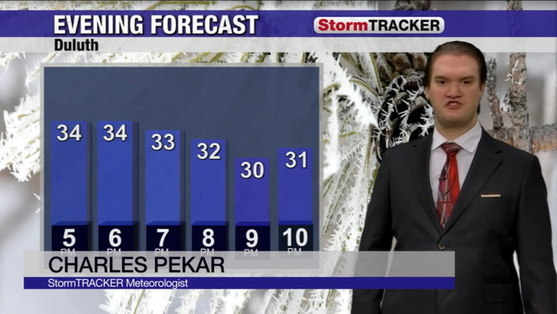
Local forecasters described a familiar but disruptive mix of flurries and slick conditions developing overnight. The emphasis was on short-term impacts, particularly for morning commuters. This reporting adds texture to the trend by showing how minor systems still demand attention when they coincide with daily routines. It reinforces the idea that winter weather influence extends beyond headline storms.
Chance for snowfall on nights in parts of Georgia this weekend

The possibility of snow in Georgia shifted the narrative southward, highlighting how unusual weather draws heightened interest even when confidence is low. Forecasters stressed nighttime timing and marginal accumulation, framing snow as a possibility rather than a promise. This cautious tone reflects lessons from past southern snow events where small amounts caused outsized disruption. The story underscores how regional expectations shape public reaction.
Will Florida and the South get hit with snow this weekend?

This national analysis placed southern snow chances in historical context, noting that while rare, such events are not unprecedented. The article examined model disagreement and the atmospheric setup required for snow to reach Florida. By comparing current conditions to past cold outbreaks, it framed the discussion as a balance between possibility and probability. This broader view helps explain why the trend resonates beyond local forecasts.
Has snow potential changed going into frigid weekend in Atlanta?

USA Today focused on forecast evolution, explaining how updated data slightly adjusted snow probabilities for Atlanta. The coverage highlighted the sensitivity of southern forecasts to minor atmospheric changes. Rather than emphasizing totals, the story explored how forecasters communicate shifting confidence to the public. It reinforces the theme of uncertainty that runs through this winter pattern.
Cold blast moving in, snow potential uncertain this weekend
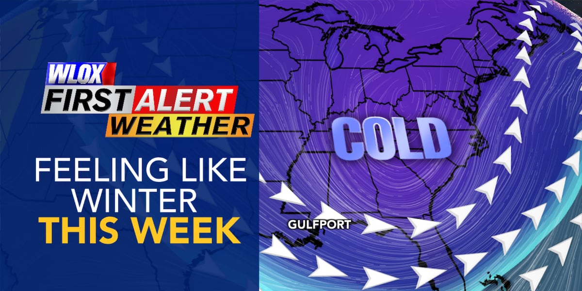
This report emphasized falling temperatures over snowfall, noting that cold alone can strain infrastructure and energy systems. Forecasters framed snow as secondary to the broader cold blast. This perspective broadens the trend beyond precipitation, reminding readers that winter impacts are multifaceted. It also aligns with historical cold snaps that produced limited snow but significant disruption.
Could Florida see snow from approaching cold front? Models say maybe

The Tallahassee Democrat examined model output variability, showing how different simulations produced different outcomes. By focusing on the science behind the uncertainty, the article avoided sensationalism while acknowledging public curiosity. This analytical approach reflects a broader trend in weather coverage toward transparency. It situates Florida within the same national system affecting much colder regions.
Snow again in New Orleans? Local weather forecasters say it’s possible, but not likely.
New Orleans forecasters referenced past rare snow events while downplaying the likelihood of a repeat. The article balanced historical memory with present-day data, illustrating how communities contextualize unusual forecasts. This careful framing avoids overstating risk while acknowledging why residents pay attention. It rounds out the national picture by showing how even low-probability events shape the trend.
Summary / Insights
Taken together, these reports show a winter weather pattern defined by reach and variability rather than uniform severity. Northern regions prepare for snow and ice as expected, while southern states watch models closely for rare outcomes. The unifying theme is uncertainty: small atmospheric shifts determine whether communities see snow, ice, or simply cold rain. Historically, similar setups have produced mixed results, reinforcing why forecasters emphasize probabilities over promises.
TL;DR: A widespread cold pattern is affecting much of the U.S., bringing snow and ice to the Midwest while raising cautious snow chances in the South. Impacts vary by region, with uncertainty playing a central role in forecasts.